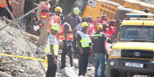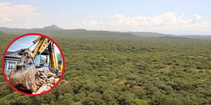

The promulgation of the 2010 Constitution birthed 47 devolved units, in the country to take power, resources and government functions closer to the people.
Each of the counties is grouped in relation to the former administrative units which were known as provinces. All of the 47 counties are led by a governor and a deputy governor.
The two who are elected on a joint ticket to form county governments. Members of the County Assembly (MCAs) have an oversight role.
The county codes are numbered from 001 to 047.

But what are some of these units know for?
Mombasa County
Mombasa county has a code of 001. It is famous for its beaches, world-class beach resorts, and it's historical significance.
It Kenya's most popular tourist destination and is the second-largest city after Nairobi.
It has an area of 212 square kilometers.
Kwale County
002 is its county code which is also situated in the former Coast province. The capital of this county is Kwale.
Kwale county has an area of 8270.3 square kilometers. It is also famous for its tourist attraction site.
It has a population of over 600,000 people mostly comprising Digo and Duruma who belong to the Mijikenda ethnic group.
Kilifi County
Kilifi is county 003. Its main town is Kilifi and it has an area of 12,245.9 square kilometers.
It has some of the most mind-blowing tourist sites where the sunrise can be beautifully captured.
The town is known for its Indian Ocean beaches, including Bofa Beach, dotted with resorts. Nearby, green turtles swim among coral reefs in Watamu Marine National Park and Reserve.
The Mnarani Ruins, archaeological remains of a centuries-old Swahili settlement, include 2 mosques and several tombs.
Tana River County
This is county 004 which also falls under the former Coast province.
The capital for this county is Hola and it covers an area of 35,375.8 square kilometers. This county is famous since it has the Tana River flowing through which connects to the Indian Ocean.
The County takes its name from River Tana which is the longest river in Kenya. It is a County in the former Coast Province, Kenya, and has a population of 262,684 according to the 2012 census.
The administrative headquarter of the county is Hola. The County has three sub-counties; Bura, Galole, and Garsen.
Lamu County
This county 005. It is not only endowed with biodiversity on the mainland but additionally has some of the richest marine ecologies on the Kenyan coastline.
The County has two National reserves: Dodori, and Kiunga Marine.
The County has a land surface area of 6,474.7 Km2 includes the mainland and over 65 Islands that form the Lamu Archipelago. The total length of the coastline is 130 km while the land water mass area stands at 308 kilometers.
People flock to Lamu for the famous Maulidi celebrations that are held during the third month of the Muslim calendar to mark the birth of Prophet Muhammad
During the celebrations, a number of entertaining events such as dhow races, a donkey race, bao games, henna painting, kofia making, swimming competitions and a football match are organized by the locals.
Another festival is the recently created Lamu Cultural Festival dedicated to celebrating and preserving the culture of the Lamu Archipelago.
Taita Taveta
This is county 006. It lies approximately 140 km northwest of Mombasa and 380 km southeast of Nairobi.
The County headquarters are located in Mwatate, which is central to the county.
It is famous for Tsavo East and Tsavo West national parks. It is also famous for ranches, estates and sanctuaries which all play a part in boosting the rate of tourism in the county.
Garissa County
This is the seventh county in Kenya, located in the former North Eastern province.
The capital of this county is Garissa and it has an area of 45,720.2 square kilometers.
The county is famous for the large number of refugee camps.
Wajir County
This is the eighth county in Kenya and it is located in the former North Eastern region and positioned near Somalia.
The capital for this county is Wajir and it has an area of 55,840.6 square kilometers. Wajir is full of resources, beautiful landscapes, exotic wildlife, and irrepressible people.
Wajir is a Borana word that means coming together, bequeathed to this part of the country because of the different clans and pastoral communities that used to congregate in areas around Wajir town to water their animals from the abundant and dependable shallow wells that characterize the general land geomorphology.
Mandera County
It is county 009. Mandera county is in the former North Eastern province with Mandera as the capital. It has an area of 25,797.7 square kilometers.
According to information from the Mandera County government, the county had an estimated population of 1,025,756 persons with 125,497 households and a density of 39 persons per km2 according to 2009 census.
The main economic activity in Mandera County is pastoralism, contributing approximately to 72 percent of the total household income. Cross-border trade, artisanal mining, beekeeping, and irrigation-aided agriculture are the other viable ventures.
Marsabit County
Marsabit County number 010 sits at the northern peak of Kenya. It shares borders with Ethiopia, Wajir County and Samburu county.
The county is subdivided into seven other sub-counties.
It is famous for hosting Marsabit National Park which is home to countless wildlife species ranging from birds elephants, leopards, buffaloes, baboons, and spotted hyenas among others.
The park also hosts Mount Marsabit tropical rainforest which is a rare scenic feature.
Kiambu County
This county is located in the former Central province. It covers an area of 2,449.2 square kilometers with headquarters in Kiambu town.
It is considered the richest county in Kenya.
Turkana County
It covers an area of 71,597.8 square kilometers and its capital is Lodwar town. It is famous because of Lake Turkana where fishing and tourism takes place.
This is the largest county in Kenya.
It hosts one of the largest nomadic communities in Kenya, they are known for their basket weaving and annual Turkana Festival.
The Turkana are mostly located in Turkana and Marsabit counties. Notable personalities include Olympic champion Paul Ereng and supermodel Ajuma Nasenyana.
Uasin Gishu County
It is county number 027. This county is in the former Rift Valley region. It covers an area of 2,955.3 square kilometers and its capital is Eldoret.
This county is famous for its huge maize plantations.
Its breathtaking iconic landscape and culture makes it the most welcoming and relaxing zone in the Rift valley.
Nakuru County
Its code is 032. Nakuru County lies in the vast Rift Valley region.
Its capital is Nakuru town which was conferred city status by President Uhuru Kenyatta.
It is popular because of Lake Nakuru and Lake Naivasha which has flamingoes.
Kericho County
It is county 035 which lies in the former Rift Valley Region. It has a population of 752, 396 according to the 2009 census.
Its capital and largest town is Kericho. Kericho County is home to the best of Kenyan tea which is renowned worldwide for its taste with its town square even known as Chai Square.
Some of the largest tea companies including Unilever Kenya, James Finlay, and Williamson Tea are based here. It is also home to the popular Ketepa brand.
Vihiga County
Vihiga county is number 038. It lies in the former Western province. It has a population of 554,622. It covers an area of 531.3 square kilometers and its capital is Vihiga.
4 major indigenous Sub-tribes that call Vihiga County home and add to the rich culture of this great County are; Maragoli people, Banyore People, Tiriki People and the Terik People.
They are famous for this rite because of the elaborate masks and body paint during circumcision ceremonies.
Busia County
It is county number 040 which is in the former Western province. It covers an area of 1,628.4 square kilometers and the capital is Busia town.
It is popular because it has a trade center for both Uganda and Kenya since it lies within the border.
Migori County
This is county 044 which is found in the former Nyanza province. It covers an area of 2,586.4 square kilometers and the capital is Migori town.
The county is famous because of the gold deposits that are found in various part within that region.
Kisii County
This is county number 045. It is situated in the former Nyanza region.
It has a population of 1,152,282. It covers an area of 1,317.9 square kilometers and its capital is Kisii town.
It is famous because of the sweet bananas that grow there.
Nairobi County
It is county number 047. This country is located in the former Nairobi province. It has an area of 694.9 square kilometers and its capital is Nairobi city. It is a metropolitan county.
In addition to its urban core, the city has Nairobi National Park, a large game reserve known for breeding endangered black rhinos and home to giraffes, zebras and lions.
Next to it is a well-regarded elephant orphanage operated by the David Sheldrick Wildlife Trust. Nairobi is also often used as a jumping-off point for safari trips elsewhere in Kenya.
Isiolo County
Its code is 011 and it is located in the former Eastern Province of Kenya. Its population is 268,002 and it's capital and largest city is Isiolo.
Isiolo is also the Least Populated County in Kenya. Isiolo County is to be the first county to be developed as part of the Kenya Vision 2030 program.
Isiolo is also known for its large market, while brass, copper and aluminum jewellery making is a local industry. Isiolo town is also a transport hub to the northern border town of Moyale.
Kisumu county
Kisumu county has a code of 042. Currently, it is one of the fastest-growing cities in Kenya.
It is thriving with rich sugar and rice irrigation industries, whose contribution to the National economy is immense due to its natural resources and as the epicenter for business in East Africa.
Attractions in the city include Kibuye Market, Oile Market, the Kisumu Museum, an impala sanctuary, a bird sanctuary, Hippo Point, Shopping malls and the nearby Kit Mikayi and Ndere Island National Park.
Meru County
Its code is 012 and lies on the leeward side of mt Kenya and is 55 kilometers from Meru town.it is located along Meru-Nanyuki highway. It is one of the assembly wards in Buuri constituency in Meru county.
It is famous for rich farmland where the finest of export – quality roses, grain crops and greenhouse horticulture are grown.
It is also known for Miraa farming.
Kakamega County
Kakamega's county code is 037 and serves as the headquarters of Mumias Sugar, previously Kenya's largest sugar processing company located in the town of Mumias.
Kakamega was the scene of the Kakamega gold rush in the early 1930s, fueled partly by the reports of the geologist Albert Ernest Kitson.
It also takes pride in being the home of bullfighting.
Laikipia
Laikipia County is one of the 14 counties within the Rift Valley region and one of the 47 counties in the Republic of Kenya.
The name Laikipia means 'treeless plain' in the Maasai language. Its code is 031.
The county has two major urban centres: Nanyuki to the southeast, and Nyahururu to the southwest.
The county is famous for being a white highland with ranches and greenhouses.
Nyeri County
According to Brittanica, Nyeri county lies at an elevation of about 5,750 feet (1,750 metres) in the heart of the Kikuyu people’s homeland, and it was a hub of Mau Mau rebel activity in the 1950s.
It serves as the gateway to Aberdare National Park. Its code is 019.
It is agricultural area with its major production being leather goods, soap, wood and furniture, processed food, soft drinks, cord, rope, twine, clay and concrete products, agricultural implements, and fabrics.
Baringo County
The code for Baringo county is 030. It is a scenic region, home to a wide range of wildlife and is a major tourism attraction. The main reserves and sanctuaries are Lakes Bogoria, Baringo and Kapnarok, and Ruko conservancy.
Lake Bogoria is perhaps Baringo County’s most popular tourist attraction site due to its active geysers. The geysers produce streams rich in Sulphur compounds, which are believed to be of medicinal value.
Trans Nzoia County
Trans Nzoia county is numbered 026. Its arable land makes agriculture the top economic activity, where maize farming is widely practised, and mostly at a commercial level.
Tea, coffee, horticulture and commercial businesses are also very significant to the county's economy.
Murang'a County
Murang’a County is intrinsically linked to the history of the Kikuyu community. According to historians, the first progenitor of the Kikuyu tribe (Gikuyu) was instructed by God to go and settle at Mukurwe wa Nyagathanga in Murang’a.
It is known for giving Nairobi its water.